Consultancy services Click here
National & international application Click here
Projects by Scenic Solutions Click here
Our clients Click here
Reasons for engaging us Click here
What Scenic Solutions is not Click here
Papers and presentations by Dr A. Lothian Click here
Subjectivity and objectivity Click here

Scenic Solutions is a consultancy practice based in Adelaide, South Australia, which has completed a series of projects and consultancies that have quantified and mapped scenic quality, developed tools for its prediction, assessed the visual impact of developments and advised on policies to enhance and manage scenic quality.
Scenic Solutions was established by Dr Andrew Lothian as a consultancy practice following his PhD on the subject: Landscape Quality Assessment of South Australia.
CONSULTANCY SERVICES
Landscape quality assessment
Measure and map the scenic quality of an area to provide quantitative and spatial information; small scale through to regional in scale.
Visual impact assessment
Assess the change to landscape quality before and after developments, including analysis of options to minimize scenic impacts.
Policy development
Assist in the development of land use planning policies, management measures, and other policy initiatives to guide the protection, enhancement and management of landscape quality.
Advisory
Advice on the likely scenic quality of an area or effect of development & land use change on scenic quality.
NATIONAL & INTERNATIONAL APPLICATION

Although the methodology employed by Scenic Solutions was developed and applied in South Australia, landscape quality can be assessed throughout Australia, at local, regional, and State levels, and also internationally.
Similarly, the assessment of land use change and of proposed developments on landscape quality can be undertaken anywhere in Australia or internationally.
Examples include wind turbine developments, major energy-related infrastructure, major road and other transport infrastructure (e.g. airports, ports, railways), and changes in land use such as vineyard or forestry developments replacing traditional grazing or arable uses.
Small projects draw on the knowledge and expertise gained from previous work in identifying the likely scenic quality of given landscapes and to assess the likely visual impact of developments.
PROJECTS BY SCENIC SOLUTIONS

Projects completed by Scenic Solutions include:
- Assessed the visual impact of wind farms in coastal and inland locations in South Australia
- Assessed the scenic amenity value of large remnant trees on agricultural land in South Australia
- Measured and mapped the landscape quality of the South Australian coast (4,800 km)
- Assessed the visual impact of coastal developments including housing, marinas and aquaculture
- Measured and mapped the scenic quality of the famous Barossa wine region
- Advised a power authority about the visual impact of potential wind farms in a range of localities across South Australia
- Advised wind farm companies about the scenic quality impact of proposed wind farms at Myponga-Sellicks and Yankalilla

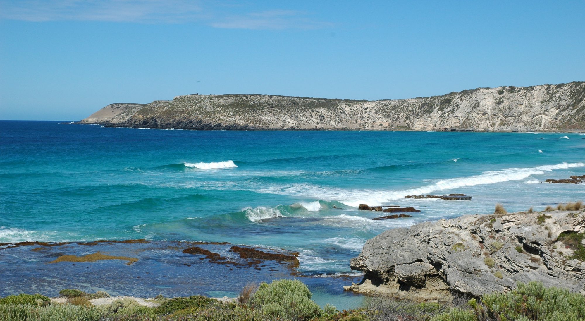
Scenic quality map of the Flinders Ranges, South Australia - Assessed the scenic quality and landscape characteristics of part of the City of Victor Harbor and advised planning policy
- Measured and mapped the scenic quality of the River Murray, Lakes and Coorong in South Australia
- Assessed community perceptions of developments on the River Murray and advised on development policy
- Measured and mapped the scenic quality of the Flinders Ranges in South Australia
- Advised on the visual impacts associated with water infrastructure
- Advised Clare & Gilbert Valleys Council on the scenic quality of the district and the potential visual impacts of wind farms
- Advised an energy company on the landscape quality of the southern Flinders Ranges & Crystal Brook area
- Defined scenic ratings for a set of generic landscapes in South Australia
- Measured and mapped the scenic quality of the Lake District in England
- Measured and mapped the scenic quality of the Mount Lofty Ranges in South Australia
- Carried out an assessment of the World’s best landscapes
- Advised on the visual impact of a major port facility on Kangaroo Island
- Assessed the visual impact and acceptability of wind farms in SA, Victoria and NSW.
- Survey of the visual impacts and acceptability to councillors of wind farms in Britain.
- British local government policies on landscape, renewables and wind farms.
A summary of these projects is available here – click here: Summary of landscape studies
OUR CLIENTS

Scenic Solutions has provided advice and services to:
- South Australian Government agencies including Department for Environment and Heritage, Department of Water, Land and Biodiversity Conservation, and Planning SA
- Local Government including the Barossa Council, Light Regional Council and the City of Victor Harbor
- South Australian Native Vegetation Council
- ETSA Utilities
- Origin Energy
- Trust Power
- SA Water
Clients are drawn from the following areas:
- Federal government agencies
- State government agencies; planning, environment, natural resources management, tourism, coastal management, development assessment
- Local government authorities for local landscape assessments, development assessments
- Companies such as energy, wind farm and water utilities and land developers
- Consultants preparing environmental impact assessments and development assessment reports
REASONS FOR ENGAGING US

- Recognition of the significance of scenic quality as an environmental asset and the need to measure and map it; this could be at a macro (e.g. state, region) or micro (e.g. local council) levels
- Recognition of scenic quality as an environmental resource and a tourism attraction in its own right and the need to assess this quantitatively as a basis for landscape enhancement and management
- Identification of scenic quality as a significant environmental resource requiring assessment in respect of proposed developments or changes of use, including assessment of the likely change to landscape quality from these developments or changes in use.
WHAT SCENIC SOLUTIONS IS NOT
Scenic Solutions is not a landscape architecture practice; it is not design-based. Nor is it a landscape gardening practice! Rather it uses social surveys (Internet-based), statistical methods and GIS systems to measure human perceptions of landscape quality, the visual impact of developments, and to map scenic quality in an objective way.
PAPERS & PRESENTATIONS BY
DR ANDREW LOTHIAN
Dr Lothian has presented his work at various conferences, both in Australia and overseas and has written papers in various journals. These are collected here.
Click on the following list of projects.
Landscape and the philosophy of aesthetics Is landscape quality inherent in the landscape or in the eye of the beholder Landscape & Urban Planning, 44, (1999), 177-198.
Amenity value of native vegetation 2000 Report to the SA Native Vegetation Authority, 11 pages (this report predated the consultancy Amenity Value of Scattered and Isolated Trees).
National assessment of visual impact of wind farms 2002 Powerpoint presentation. Australian Wind Energy Conference, Adelaide 2002 (This paper preceded the visual impact of wind farms assessment project but outlines the approach) 9 MB
Amenity Value of Scattered and Isolated Trees. Report to the SA Native Vegetation Council. 2004. 97 pp.
Scenic Perceptions of the Visual Effects of Wind farms This study on the visual impacts of hypothetical wind farms on South Australian landscapes was conducted in 2004 and published in 2008.
Wind Energy Industry’s Responsibility for Visual Impact, a Study of the Visual Effects of Wind Farms in South Australia Partnerships for Sustainable Development. November 7 – 10, 2004 12th International Conference of Greening of Industry Network Hong Kong. 26 pages.
Coastal landscape assessment Powerpoint presentation. Coast to Coast Conference, Melbourne, 2006 (Summary of the Coastal Viewscapes Project) 26 MB.
Coastal Landscape Assessment The South Australian Coastal Viewscapes Project Paper, Coast to Coast Conference, Melbourne, 2006, 15 pp.
An innovative landscape quality assessment methodology Powerpoint presentation. Planning Institute of Australia and New Zealand Planning Institute Congress, Cowes, Phillip Island, Victoria, 2006 (Summary of landscape quality assessment method and its application in South Australia) 36 MB
An innovative landscape quality assessment methodology Paper presented to the Planning Institute of Australia and New Zealand Planning Institute Congress, Cowes, Phillip Island, Victoria, 2006. 30 pages.
Visual impact assessment of some developments in South Australia 2008. Australian Planner, 45:4, pp 35 – 41.
Landscape management for coastal regions Cases of Australia and their applicability to Korea 2009. Paper. Presentation to the International Experts Forum on Landscape Management, Seoul, Republic of Korea, 3 November.
Landscape management for coastal regions Cases of Australia and their applicability to Korea. 2009. Powerpoint. Presentation to the International Experts Forum on Landscape Management, Seoul, Republic of Korea, 3 November. 20 MB.
Aesthetics of water in the urban environment. Chapter 19, Adelaide Water of a City, 2010. 12 pages.
Landscape quality assessment studies in South Australia, South Australian Geographical Journal, Vol 106, 2007. 24 pages.
Measuring and mapping landscape quality using the community preferences method Paper presented to the New Zealand Planning Institute, Blenheim, New Zealand, 2 May 2012. 43 pages. (The paper covers the method and its application in the New Zealand context).
Assessing landscape quality an alternative approach. Powerpoint presentation to the New Zealand Planning Institute, Blenheim, New Zealand, 2 May 2012. 43 pages. 10MB.
Generic landscape survey report 2013. 74 pages, 11 MB. Uses generic landscape scenes and modifies them with Photoshop.
Landscape quality assessment and the Lake District study Presentation to Flinders University Research Colloquium, 13 August, 2014 13 MB.
A potential method for the assessment of Criterion VII World Heritage Convention 2014. 12 pages, 0.8 MB.
Scenic Beauty Can it be measured and mapped Powerpoint presentation to the Royal Geographical Society of South Australia, 16 November, 2017. 23 MB.
Visual Resource Stewardship – An International Perspective Visual Resource Stewardship Conference, Argonne National Laboratory, Chicago, United States, October 27 – 30, 2019. Available through Land, 11:3, https://doi.org/10.3390/land11030451
Measuring and Mapping Scenic Quality using the Community Preferences Method. Visual Resource Stewardship Conference, Argonne National Laboratory, Chicago, United States, October 27 – 30, 2019.
A survey of the visual impact and community acceptance of wind farms in Australia. Australian Planner, October, 2020. This can be accessed here.
Survey of the visual impacts and acceptability to councillors of wind farms in Britain, 2020.
British local government policies on landscape, renewables and wind farms. 2021.
Visual impacts and acceptability of wind farms to councillors and senior council staff in Britain, International Journal of Environmental Studies 2022
DOI: 10.1080/00207233.2021.2017174
In April, 2021, Dr Lothian spoke (by Zoom) at the Mountain Creeks to Metro Canals River Management Symposium, held in Virginia, United States. He spoke on Measuring the scenic quality of rivers. His paper and Powerpoint presentation are available here: Virginia Rivers paper Virginia Rivers Powerpoint presentation.
Application of the Community Preferences Method, 2000 – 2020 Scenic Solutions. 2022.
SUBJECTIVITY AND OBJECTIVITY
The challenge is the scenic quality is a subjective quality. “Beauty is in the eyes of the beholder” is the common cliché implying that it is therefore impossible to measure and map in an objective way.
The projects completed by Scenic Solutions shows that this is false as scenic quality can be measured and mapped in a manner which is not only objective but also provides the means for predicting scenic quality. Furthermore, the visual impact of developments can also be assessed objectively.
There are few practitioners in Australia able to measure and map scenic quality in an objective, rigorous and replicable manner. Practitioners of some landscape design consultancies have been involved in landscape quality assessment but this has been on the basis of their expertise in design rather than on the basis of expertise in measuring human aesthetic preferences.